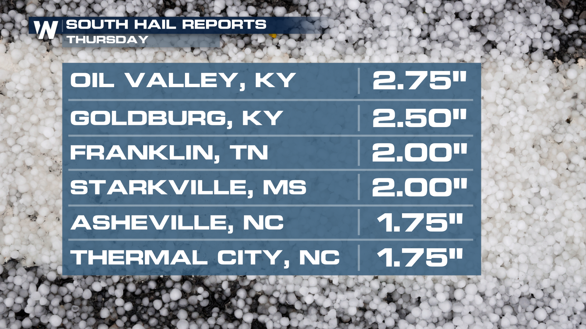
Huge Hail in the Mid-South Thursday, Storms Linger in the Carolinas Today

Hail over the size of tennis balls and baseballs fell across the Mid-South and Southeast on Thursday! The storm system responsible is heading toward the coast, where the threat will persist through this evening.
 Today's Risk
The threat of severe storms will follow the cold front to the coast this afternoon, with a slightly higher risk for the Outer Banks, where wind and hail damage is more likely.
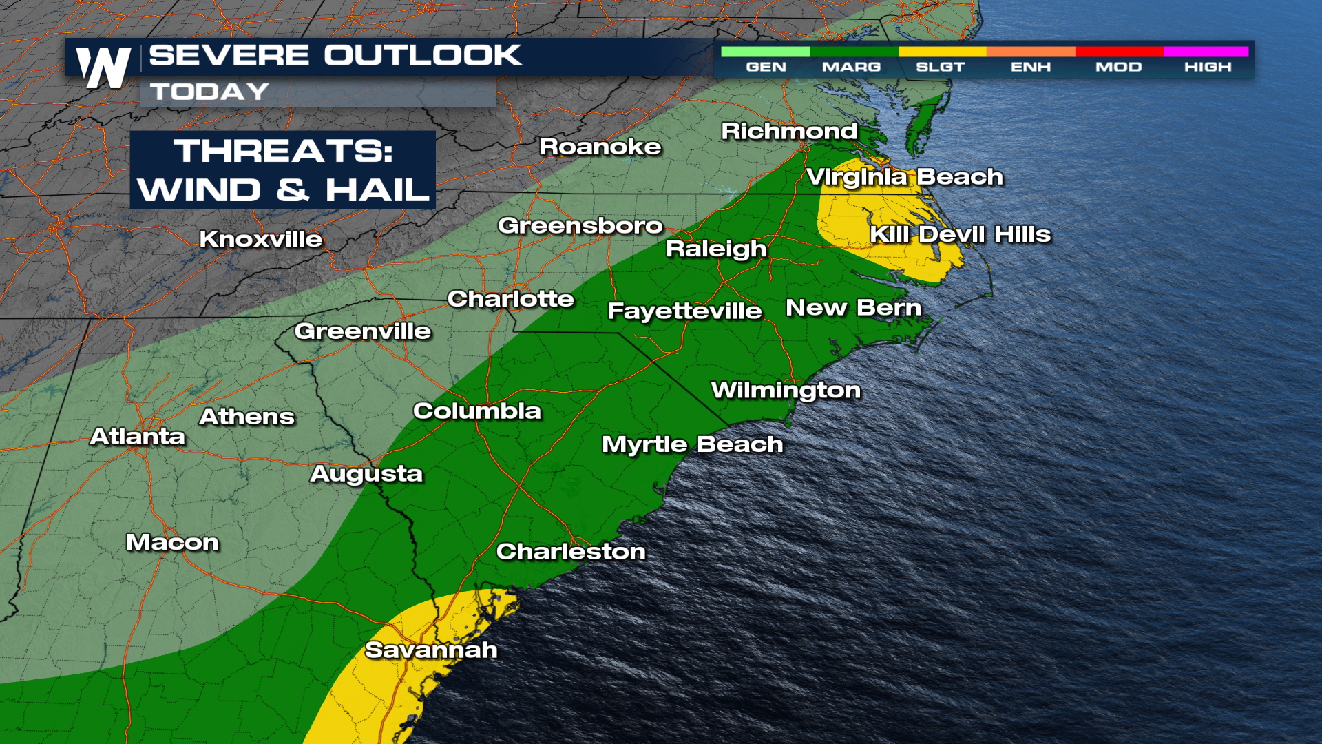
This morning's storms have given way to some clearing before the front taps into daytime heating. Most severe storms are likely to be offshore by around dinner time or shortly thereafter.
Unfortunately, with multiple rounds of storms, the flooding threat remains through the end of the week. For more details on the longer-range flood threat for areas like Florida, Georgia, and the Carolinas, read this related article here: Southeast Soaker This Weekend.
Tune into WeatheNation for the latest details.


